Skip to Content
AccessibilityCareersSubscribeContact UsDonate Now

Saugeen Valley Conservation Authority Logo

Contact Us
  • Outdoors and
    Recreation
    View our Outdoors and Recreation page
    • Camping
      • Reserve a Campsite
      • Reservation Changes or Cancellations
      • Group Camping
      • Firewood
      • Rules and Regulations
      • Seasonal Camper Information
    • Activities and Recreation
      • Canoeing and Kayaking
      • Fishing
      • Hunting
      • Rent a Facility
      • Trails and Hiking
    • Outdoor Spaces
      • Allan Park
      • Bell's Lake
      • Brucedale
      • Denny's Dam
      • Durham
      • Hardwood Hill
      • Kinghurst
      • McBeath
      • Mildmay-Carrick
      • Saugeen Bluffs
      • Schmidt Lake
      • Stoney Island
      • Sulphur Spring
      • Varney
  • Permits and
    Planning
    View our Permits and Planning page
    • Applying for a Permit
    • Book a Planning Act Pre-Submission Consultation
    • Environmental Regulations
    • Maps and GIS
    • Municipal MOU Technical Service Agreements
    • Planning and Regulations FAQ
    • Planning Services
    • Report a Concern
  • Forestry and
    Landowner Services
    View our Forestry and Landowner Services page
    • Forestry and Land Management
    • Stewardship Projects and Services
    • Tree Planting and Sales
    • Water Well Improvement Program
  • Water Management
    and Protection
    View our Water Management and Protection page
    • Flood Forecasting and Warning
    • Drinking Water Source Protection
    • Water Quality Monitoring
    • Water Well Improvement Program
    • Watershed Report Cards
  • Education
    Programs
    View our Education Programs page
    • Education Programs
      • Borrow an Outdoor Educator
      • Bruce Grey Forest Festival
      • Community Youth Programming
      • DEER Programs
      • Earth Week Programs
      • Flood Waters and You
      • Grey Bruce Children’s Water Festival
      • Sulphur Spring Outdoor School
      • Wild Encounters Outdoor School
      • Wild Encounters Summer Nature Day Camp
      • WREN Programs
      • Youth Outdoor Expo
      • Nature Notes with Nancy
    • Get Involved
      • Events
  • About
    Us
    View our About Us page
    • Accessibility and Customer Service Standards
    • Board of Directors
    • Careers
    • Contact Us
    • Donate Now
    • Fees
    • Freedom of Information
    • Governance
    • Hours and Location
    • Meeting Calendar
    • Meeting Summaries
    • News and Notices
    • Tenders and RFPs
x

Groundwater Monitoring

HomeWater Management and ProtectionWater Quality MonitoringGroundwater Monitoring
  • Facebook
  • Twitter
  • LinkedIn
  • Email

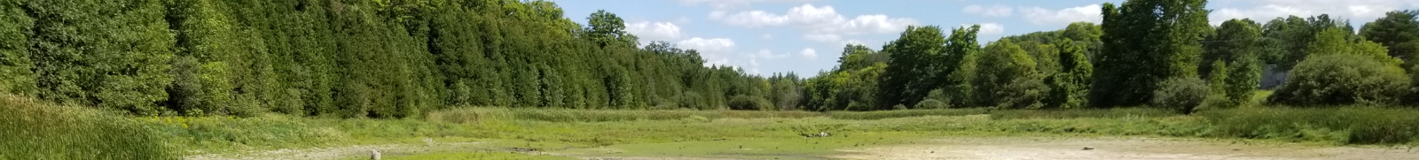
Groundwater monitoring

A network of groundwater monitoring wells has been established across the watershed to monitor the quality and quantity of the groundwater resources in the SVCA watershed.
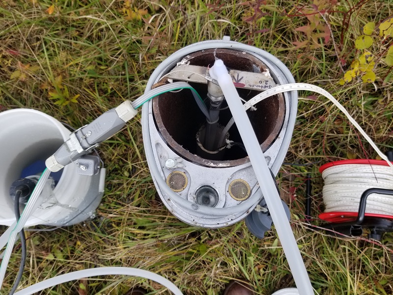
Ground Water Monitoring Equipment

Data from these wells is being used to make informed decisions about water testing and treatment of private wells, water allocation (under the Ministry of the Environment, Conservation and Parks Permit To-Take-Water program), drinking water source protection planning, and potential climate change impacts.

The data will also be used in the future as a low water response indicator for various stages of drought.

Results from water quality sampling areas are used to inform municipalities of any exceedances of the Ontario’s Drinking Water Quality Management Standard that might occur in aquifers within their jurisdiction.

The 17 wells and 23 aquifers established by SVCA are part of the Provincial Groundwater Monitoring Network (PGMN) which is a partnership program with all 36 Ontario conservation authorities to collect and manage ambient groundwater levels. By keeping a long-term record of groundwater quality and quantity, we're able to identify potential contaminant sources and effective remediation strategies. This data serves as an early warning system for changes in our aquifers, caused by climatic conditions or human activities, and allows us to make sound land-use decisions. 

Rain gauges have also been added into the network at various well sites in order to gain a better understanding of the correlations between precipitation and groundwater levels.  

Subscribe to page updates

Contact Us

  • Water Quality Monitoring
    Toggle Section Water Quality Monitoring Menu
    • Biomonitoring
    • Groundwater Monitoring
    • Surface Water Monitoring
  • Close Full Water Management and Protection Menu
    Toggle Section
    • Flood Forecasting and Warning
      Toggle Section Flood Forecasting and Warning Menu
      • Flood Messages
      • Low Water Advisories
      • Low Water Response
      • Map of Streamflow Monitoring Stations
      • Streamflow and Climate Data
      • Water and Erosion Control Infrastructure
    • Drinking Water Source Protection
    • Water Well Improvement Program
    • Watershed Report Cards

Saugeen Valley Conservation Authority footer logo

1078 Bruce Rd. 12
Box 150
Formosa, Ontario
N0G 1W0

Phone: (519) 364-1255
Send an Email

  • Follow Us

    • Facebook
    • Twitter
    • YouTube
    • Instagram
  • Links

    • Accessibility
    • Freedom of Information
    • Privacy Statement
    • Sitemap
    • Website Feedback
    • Contact Us

© Copyright 2021 Saugeen Valley Conservation Authority

Designed by eSolutionsGroup

Browser Compatibility Notification

It appears you are trying to access this site using an outdated browser. As a result, parts of the site may not function properly for you. We recommend updating your browser to its most recent version at your earliest convenience.