Skip to Content
AccessibilityCareersSubscribeContact UsDonate Now

Saugeen Valley Conservation Authority Logo

Contact Us
  • Outdoors and
    Recreation
    View our Outdoors and Recreation page
    • Camping
      • Reserve a Campsite
      • Reservation Changes or Cancellations
      • Group Camping
      • Firewood
      • Rules and Regulations
      • Seasonal Camper Information
    • Activities and Recreation
      • Canoeing and Kayaking
      • Fishing
      • Hunting
      • Rent a Facility
      • Trails and Hiking
    • Outdoor Spaces
      • Allan Park
      • Bell's Lake
      • Brucedale
      • Denny's Dam
      • Durham
      • Hardwood Hill
      • Kinghurst
      • McBeath
      • Mildmay-Carrick
      • Saugeen Bluffs
      • Schmidt Lake
      • Stoney Island
      • Sulphur Spring
      • Varney
  • Permits and
    Planning
    View our Permits and Planning page
    • Appeal Process
    • Applying for a Permit
    • Book a Planning Act Pre-Submission Consultation
    • Environmental Regulations
    • Maps and GIS
    • Municipal MOU Technical Service Agreements
    • Planning and Regulations FAQ
    • Planning Services
    • Report a Concern
  • Forestry and
    Landowner Services
    View our Forestry and Landowner Services page
    • Forestry and Land Management
    • Stewardship Projects and Services
    • Tree Planting and Sales
  • Water Management
    and Protection
    View our Water Management and Protection page
    • Flood Forecasting and Warning
    • Drinking Water Source Protection
    • Water Quality Monitoring
    • Water Well Improvement Program
    • Watershed Report Cards
  • Education
    Programs
    View our Education Programs page
    • Education Programs
      • Bruce Grey Forest Festival
      • Community Youth Programming
      • DEER Programs
      • Earth Week Programs
      • Flood Waters and You
      • Grey Bruce Children’s Water Festival
      • Sulphur Spring Outdoor School
      • Wild Encounters Summer Nature Day Camp
      • WREN Programs
      • Youth Outdoor Expo
      • Nature Notes with Nancy
    • Get Involved
      • Events
  • About
    Us
    View our About Us page
    • Accessibility and Customer Service Standards
    • Board of Directors
    • Careers
    • Contact Us
    • Donate Now
    • Fees
    • Freedom of Information
    • Governance
    • Hours and Location
    • Meeting Calendar
    • Meeting Summaries
    • News and Notices
    • Tenders and RFPs
x

Outdoor Spaces

HomeOutdoors and RecreationOutdoor Spaces
  • Facebook
  • Twitter
  • LinkedIn
  • Email

Saugeen Conservation owns over 8,000 ha (21,000 acres) of land. This land includes significant wetlands, forests, riverine systems and headwater areas.  These consist of:

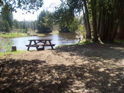
Conservation Area Photo
Conservation Areas
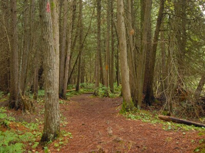
Managed Forest Photo
Managed Forests
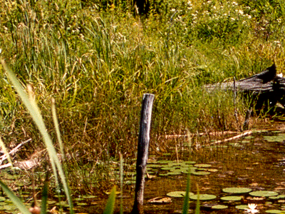
Wetland Complex Photo
Wetland Complexes

Each property has characteristics that identify it.  The two we use are Conservation Area and Managed Forest. You can find the property identification on each Outdoor Spaces page.

 Conservation Areas

 Each Conservation Area is unique. They feature some of the following things:

  • Washrooms
  • Picnic shelters
  • Recreational trails
  • Campgrounds
  • Recreational activities
  • Scenic areas

The following properties are Conservation Areas:

  • Allan Park
  • Brucedale
  • Denny's Dam
  • Durham
  • McBeath
  • Saugeen Bluffs
  • Stoney Island
  • Sulphur Spring
  • Varney
 Managed Forests
  • Saugeen Conservation owns a total of 8,400 ha (21,000 acres) of land throughout the watershed. Many of these are identified as Managed Forests. Managed forest techniques look at the health of a forest by assessing trees in the woodland.
  • Management also encourages regeneration by providing proper space and lighting. It helps with the growth of crops or seed trees to ensure future sustainability.
  • We may use management practices like selective harvesting or thinning within these areas.
  • Some of our properties have Managed Forests attached to Conservation Areas and/or Wetland Complexes.The following properties have Managed Forests:
  • The following properties have Managed Forests:
    • Allan Park
    • Bell's Lake
    • Brucedale
    • Denny's Dam
    • Durham
    • Hardwood Hill
    • Kinghurst
    • McBeath
    • Mildmay/Carrick
    • Saugeen Bluffs
    • Schmidt Lake
    • Stoney Island
    • Sulphur Spring
  • There are other tracts of land where we manage forests besides the ones on this list.  These are properties where there are no recreational activities available.
Subscribe to page updates

Contact Us

  • Outdoor Spaces
    Toggle Section Outdoor Spaces Menu
    • Allan Park
    • Bell's Lake
    • Brucedale
    • Denny's Dam
    • Durham
    • Hardwood Hill
    • Kinghurst
    • McBeath
    • Mildmay-Carrick
    • Saugeen Bluffs
    • Schmidt Lake
    • Stoney Island
    • Sulphur Spring
    • Varney
  • Close Full Outdoors and Recreation Menu
    Toggle Section
    • Camping
      Toggle Section Camping Menu
      • Reserve a Campsite
      • Reservation Changes or Cancellations
      • Group Camping
      • Firewood
      • Rules and Regulations
      • Seasonal Camper Information
    • Activities and Recreation
      Toggle Section Activities and Recreation Menu
      • Canoeing and Kayaking
      • Fishing
      • Hunting
      • Rent a Facility
      • Trails and Hiking

Saugeen Valley Conservation Authority footer logo

1078 Bruce Rd. 12
Box 150
Formosa, Ontario
N0G 1W0

Phone: (519) 364-1255
Send an Email

  • Follow Us

    • Facebook
    • Twitter
    • YouTube
    • Instagram
  • Links

    • Accessibility
    • Freedom of Information
    • Privacy Statement
    • Sitemap
    • Website Feedback
    • Contact Us

© Copyright 2021 Saugeen Valley Conservation Authority

Designed by eSolutionsGroup

Browser Compatibility Notification

It appears you are trying to access this site using an outdated browser. As a result, parts of the site may not function properly for you. We recommend updating your browser to its most recent version at your earliest convenience.