Skip to Content
Camping ReservationsCareersContact UsDonate Now

Saugeen Valley Conservation Authority Logo

Contact Us
  • Outdoors and Recreation
    View our Outdoors and Recreation page
    • Camping
      • Durham Winter Camping
      • Reserve a Campsite
      • Group Camping
      • Firewood
      • Rules and Regulations
    • Activities and Recreation
      • Canoeing and Kayaking
      • Day Use Fees
      • Fishing
      • Hunting
      • Rent a Facility
      • Trails and Hiking
      • Saugeen Bluffs Events
      • Winter Camping at Durham CA
    • Outdoor Spaces
      • Allan Park
      • Bell's Lake
      • Brucedale
      • Denny's Dam
      • Durham
      • Hardwood Hill
      • Kinghurst
      • McBeath
      • Mildmay-Carrick
      • Saugeen Bluffs
      • Schmidt Lake
      • Stoney Island
      • Sulphur Spring
      • Varney
  • Permits and
    Planning
    View our Permits and Planning page
    • Appeal Process
    • Applying for a Permit
    • Book a Planning Act Pre-Submission Consultation
    • Environmental Regulations
    • Maps and GIS
    • Agreements
    • Planning and Regulations FAQ
    • Planning Services
    • Report a Concern
  • Forestry and
    Landowner Services
    View our Forestry and Landowner Services page
    • Forestry and Land Management
    • Stewardship Projects and Services
    • Tree Planting and Sales
  • Water Management
    and Protection
    View our Water Management and Protection page
    • Drinking Water Source Protection
    • Flood Forecasting and Warning
    • Frequently Asked Questions
    • Water Quality Monitoring
    • Water Well Improvement Program
    • Watershed Report Cards
    • Water and Climate Data
    • Water and Erosion Control Infrastructure
  • About
    Us
    View our About Us page
    • Accessibility and Customer Service Standards
    • Board of Directors
    • Careers
    • Committees
    • Contact Us
    • Delegation Request
    • Donate Now
    • Freedom of Information
    • Governance
    • Hours and Location
    • Meeting Calendar
    • Meeting Summaries
    • News and Notices
    • Subscribe
    • Tenders and RFPs
x

August 5, 2025 - Collaborative Water Data Viewer Launced

HomeAbout UsNews and Notices
  • Facebook
  • Twitter
  • LinkedIn
  • Email
Back to Search

FOR IMMEDIATE RELEASE – August 5th, 2025

Saugeen Valley Conservation Authority Launches Online Access to Real-Time Water Data

ALL SAUGEEN WATERSHED MUNICIPALITIES – Municipality of Arran-Elderslie, Municipality of Brockton, Township of Chatsworth, Municipality of Grey Highlands, Town of Hanover, Township of Howick, Municipality of Morris-Turnberry, Municipality of South Bruce, Township of Huron-Kinloss, Municipality of Kincardine, Town of Minto, Township of Wellington-North, Town of Saugeen Shores, Township of Southgate, Municipality of West Grey.

Saugeen Valley Conservation Authority (SVCA) is pleased to announce that real-time data from its hydrometric monitoring network is now available online through the Collaborative Water Data Viewer (CWDV). This open-data platform allows municipalities, stakeholders, and the public to explore up-to-date watershed information directly from SVCA’s monitoring stations. 

SVCA has been sharing historic rainfall and snow data, updated on a biannual basis, since 2023. Now in addition to this historical data, the CWDV updates hourly, as new data becomes available from SVCA’s hydrometric network, providing users with near real-time and historical information. The CWDV also provides access to additional historic and current data, not previously available, including water level, streamflow, air temperature, water temperature, and soil moisture.

Over 180 stations across several Conservation Authorities are available on the CWDV, with some records dating back as far as 1914.

Data from SVCA’s hydrometric network is collected and managed through the Water Information System by Kisters (WISKI). Through a long-standing cost-sharing partnership with 10 other Conservation Authorities in the Western Ontario Data Hub, hosted by Upper Thames River Conservation Authority, SVCA now makes this information available at no cost to users.

“The CWDV is an important step forward in transparency, accessibility, and watershed engagement. Our partners and the public can now access reliable environmental monitoring data in real time, supporting emergency preparedness, research, and responsible planning.”

-          Katie Thomas, Manager of Water Resources at SVCA.

The CWDV allows users to graph, view, and download data in a range of formats. It is designed to serve everyone from municipal emergency coordinators to curious residents and local educators. Training opportunities for municipal users are planned for late 2025, and SVCA is exploring future expansion to include additional data sets such as groundwater and water quality.

Explore the Collaborative Water Data Viewer today at:

www.saugeenconservation.ca/data

For more information, please contact:
Saugeen Valley Conservation Authority
Email: media@svca.on.ca  |  Cell: 519-369-4295
Website: www.saugeenconservation.ca

Stream Gauge Station

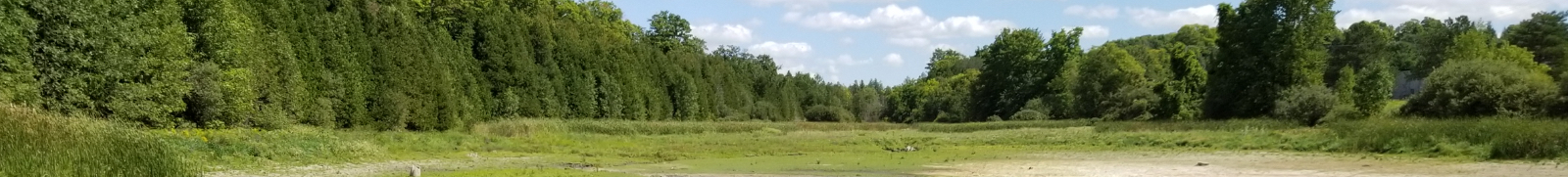
Photo credit: SVCA. Stream gauge station and rain gauge located on the South Pine River above. Data is collected automatically by the station and transmitted hourly through a satellite network for use by flood forecasting and warning staff.

Subscribe to page updates

Contact Us

Subscribe

  • News and Notices
    Toggle Section News and Notices Menu
    • Careers
    • Flood Messages
    • Low Water Advisories
    • Media Releases
    • Newsletter Sign Up
    • Subscribe
  • Close Full About Us Menu
    Toggle Section
    • Accessibility and Customer Service Standards
    • Board of Directors
    • Careers
    • Committees
    • Contact Us
    • Delegation Request
    • Donate Now
    • Freedom of Information
    • Governance
    • Hours and Location
    • Meeting Calendar
    • Meeting Summaries
    • Subscribe
    • Tenders and RFPs

Saugeen Valley Conservation Authority footer logo

1078 Bruce Rd. 12
Box 150
Formosa, Ontario
N0G 1W0

Phone: (519) 364-1255
Send an Email

  • Follow Us

    • Facebook
    • Twitter
    • Instagram
  • Links

    • Accessibility
    • Freedom of Information
    • Privacy Statement
    • Sitemap
    • Website Feedback
    • Contact Us

© Copyright 2021 Saugeen Valley Conservation Authority

Designed by eSolutionsGroup

Browser Compatibility Notification

It appears you are trying to access this site using an outdated browser. As a result, parts of the site may not function properly for you. We recommend updating your browser to its most recent version at your earliest convenience.