Search
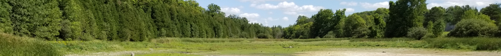
2025 Durham Conservation Area to Undergo Fence Installation
Posted on Wednesday, July 02, 2025 01:56 PM
FOR IMMEDIATE RELEASE – July 2nd, 2025
Durham Conservation Area to Undergo Fence Installation for Enhanced Safety and Property Stewardship
DURHAM, ON - Saugeen Valley Conservation Authority (SVCA) will begin installation of a new fence at Durham Conservation Area this July, a project designed to enhance public safety, deter unauthorized activity, and align with provincial regulations governing conservation lands.
The fence will secure the boundaries of the campground and adjacent conservation area....
May 22, 2025 - Stoney Island Community Tree Plant
Posted on Thursday, May 22, 2025 01:57 PM
FOR IMMEDIATE RELEASE – Thursday, May 22nd, 2025
Thousands of Trees Planted at Stoney Island Conservation Area After Ash Removal
ALL SAUGEEN WATERSHED MUNICIPALITIES – Municipality of Arran-Elderslie, Municipality of Brockton, Township of Chatsworth, Municipality of Grey Highlands, Town of Hanover, Township of Howick, Municipality of Morris-Turnberry, Municipality of South Bruce, Township of Huron-Kinloss, Municipality of Kincardine, Town of Minto, Township of Wellington North, Town of Saugeen...
May 16, 2025 - Stoney Island CA Investment
Posted on Friday, May 16, 2025 08:41 AM
May 16th, 2025
Saugeen Valley Conservation Authority (SVCA) is celebrating a $100,000 investment from the Government of Canada through the Federal Economic Development Agency for Southern Ontario (FedDev Ontario) to support critical improvements at Stoney Island Conservation Area. Announced in October 2024, this investment is enhancing accessibility and amenities to create a more inclusive and sustainable outdoor recreation experience for visitors.
The project focuses on strengthening Ontario’s tourism...
May 13, 2025 SVCA Ensures Timely, Expert Guidance for Sustainable Development
Posted on Tuesday, May 13, 2025 11:20 AM
FOR IMMEDIATE RELEASE – May 13th, 2025
Saugeen Valley Conservation Authority SVCA Ensures Timely, Expert Guidance for Sustainable DevelopmentALL SAUGEEN WATERSHED MUNICIPALITIES – Municipality of Arran-Elderslie, Municipality of Brockton, Township of
Chatsworth, Municipality of Grey Highlands, Town of Hanover, Township of Howick, Municipality of Morris-Turnberry, Municipality of South Bruce, Township of Huron-Kinloss, Municipality of Kincardine, Town of Minto, Township of Wellington-North, Town...
May 1, 2025 - Community Tree Plant, Stoney Island
Posted on Thursday, May 01, 2025 10:59 AM
FOR IMMEDIATE RELEASE – Thursday, May 1st, 2025
Saugeen Valley Conservation Authority Invites Volunteers to Help Plant Trees at Stoney Island Conservation AreaALL SAUGEEN WATERSHED MUNICIPALITIES – Municipality of Arran-Elderslie, Municipality of Brockton, Township of Chatsworth, Municipality of Grey Highlands, Town of Hanover, Township of Howick, Municipality of Morris-Turnberry, Municipality of South Bruce, Township of Huron-Kinloss, Municipality of Kincardine, Town of Minto, Township of...
Contact Us